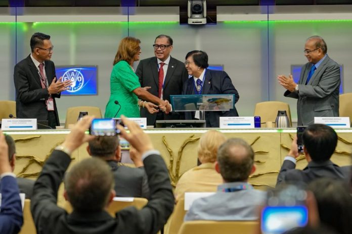
The Indonesian Minister of Environment and Forestry, Siti Nurbaya, unveiled the 2024 edition of The State of Indonesia’s Forests (SOIFO) report. The publication provides updated data and insights into the condition of Indonesia’s forests, addressing current challenges and future opportunities in forest management.
The launch event, held as a talk show themed “Advancing Forest Sustainability and Climate Resilience Through Enhanced Forest Monitoring Systems,” took place during the 27th session of the FAO Committee on Forestry (COFO) at FAO headquarters in Rome.
During the event, Minister Siti introduced the National Forest Monitoring System (SIMONTANA), a platform designed to support sustainable forest management and climate resilience, as well as to enhance international collaboration.
“SIMONTANA is an integrated monitoring platform featuring remote sensing and terrestrial technologies. It provides crucial data on forest resources, cover types, volume estimates, growth rates, national forest assessments, and biodiversity status within forest areas,” explained Siti.
She highlighted that SIMONTANA serves as a vital repository of national forest cover data, essential for forestry planning and climate mitigation strategies.
“This real-time data accessibility equips all stakeholders with the insights needed for timely policy formulation and decision-making, particularly in Indonesia’s efforts to achieve the FOLU Net Sink 2030 target,” she added.
FAO Deputy Director-General Maria Helena Semedo, who spoke at the event, praised SIMONTANA’s innovation. “FAO values Indonesia’s efforts in forest conservation and stands ready to provide support,” said Maria.
Indroyono Soesilo, Chairman of the Indonesian Forest Concessionaires Association (APHI), also spoke at the event, emphasizing that SIMONTANA’s data guides forest concession companies in field activities and supports the FOLU Net Sink 2030 target.
“SIMONTANA underpins forestry planning, peat inventory, monitoring of planting and production, forest protection, and mitigation actions,” Indroyono noted.
He detailed that high-resolution satellite imagery and field checks ensure data accuracy and validity, which are then mapped and digitized. Indroyono also mentioned that many concession companies use technologies like LIDAR for precise peat inventory and topographical mapping.
Furthermore, Indroyono highlighted the use of satellite imagery and drones for monitoring harvesting and planting activities, which assists the Ministry of Environment and Forestry (KLHK) in evaluating concessionaire performance and determining site-specific mitigation actions. ***


